A Beginner’s Guide to Backpacking in Desolation Wilderness
Desolation Wilderness is one of the first places that made me fall head over heels in love with backpacking. The majority of my first backpacking trips were taken amidst Desolation’s dramatic mountain scenery - under the jagged granite peaks, wildflower filled meadows and sparkling alpine lakes. It’s the place that taught me how magical it can be to carry everything you need on your back, sleep under a sky full of stars, wake up to the sun crawling across mountain peaks and feel an overwhelming sense of accomplishment after a strenuous few days in the backcountry.
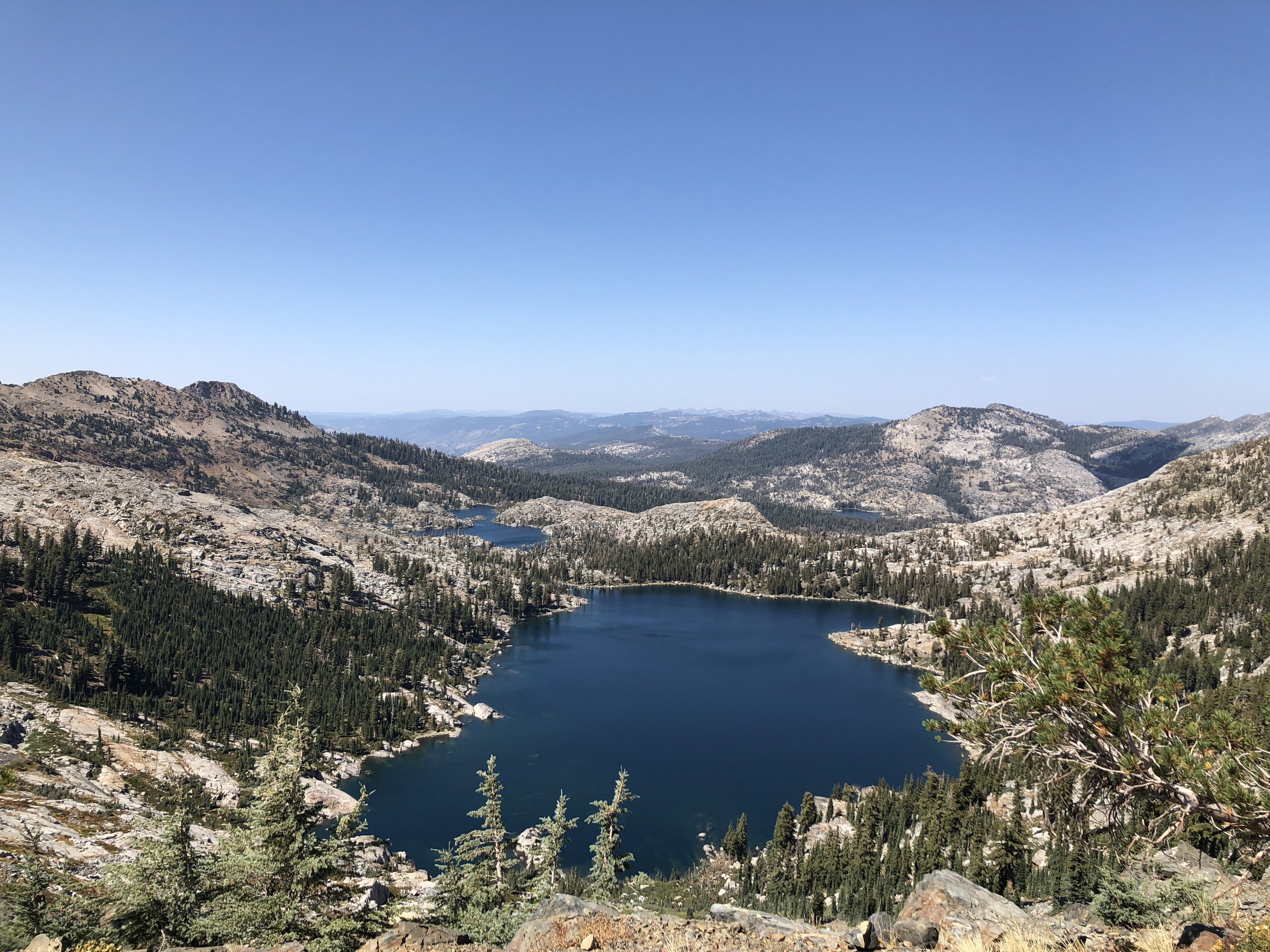
Desolation Wilderness is located in the Crystal Range of the Sierra Nevada and covers 63,960 acres west of South Lake Tahoe in El Dorado County. A ~3.5 hour drive from the Bay Area makes it a great fit for a weekend of solitude or a longer multi-day trek. The area is dotted with 100+ miles of trails and is well-known for its beautiful lakes. It is the perfect wilderness area for beginner backpackers with plenty of approachable terrain that feels challenging yet pays off with spectacular views. Below is our guide to your first backpacking trip in Desolation Wilderness - where and how to plan an unforgettable backpacking experience.
Permitting and Zones
Desolation Wilderness is highly visited and uses a permitting system to manage the area. The permitting system ensures the wilderness area is not overused and overcrowded. Desolation Wilderness uses a zone permit system which is destination based and divides the wilderness into 45 zones. Zones are numbered from north to south and a Forest Service map of the zones can be found here. Each zone varies in size and terrain and has a different permit quota (the number of permits that can be issued for each day). The permit quota for any given zone depends on size, terrain and how much use it can withstand. A list of zone quotas can be found here. In order to book a permit, you are required to choose which zone you would like to camp in for your first night. You must enter the wilderness on the date specified on your permit and stay in your chosen zone for the first night. Afterwards, you are free to stay in any zone you like during the remainder of your stay. Visitors to Desolation Wilderness must obtain an overnight permit year-round but the quota system is only in effect the Friday before Memorial Day to September 30 each year. Permits cost $6 for a reservation fee + $5 per person on the trip and can be booked on recreation.gov or picked up at one of Desolation Wilderness’s four ranger stations. 70% of permits are available online as far as 6 months in advance of start date and the remaining 30% are reserved for first-come, first-served permits issued at ranger stations.

Trailheads and Getting There
There are 13 trailheads that can be used to access Desolation Wilderness. Eagle Falls, Pyramid Creek, Loon Lake, Rockbound and Twin Lakes parking areas require a day use fee but this is waived for overnight permit holders. An overnight parking pass must be printed and displayed in vehicles. Trailheads fill incredibly early, especially on summer weekends when there is heavy day use of these areas. Plan to arrive early to secure a parking spot or arrive mid-afternoon when day hikers have completed their hikes and parking spots become available (be sure to allow enough hiking time to your destination!). Parking is not reserved or guaranteed for backpacking permit holders.
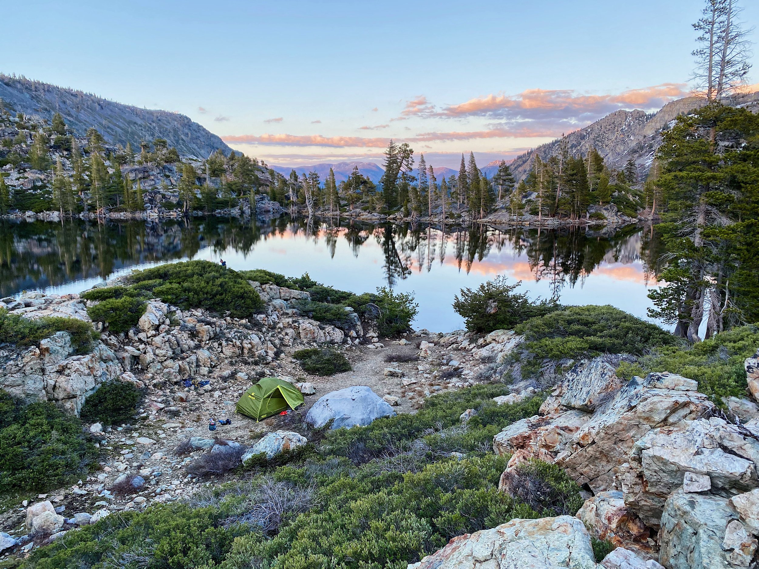
Campsites
With the exception of a few lakes, Desolation Wilderness allows dispersed camping. This means you can set up camp anywhere in the zone so long as you are following wilderness regulations. Camp on a durable, previously impacted surface and camp 100+ feet from water sources (including lake shorelines) and trails. The lakes that require using designated campsites are Lake of the Woods, Eagle Lake and Grouse and Hemlock.
Trip Itinerary Recommendations
There are endless routes that are great for beginners but we have rounded up a few of our favorites! Criteria for the trips recommended below are (1) easy to moderate in difficulty, (2) low mileage and elevation gain, (3) accessible water sources for drinking water and cooking needs, (4) easy navigation and well-marked trails, (5) provide the comfort of having other backpackers around in case of emergency. They are also all incredibly beautiful routes! We have selected a few 1 night/2 day trips and a few 2 night/3 day trips. Trips are listed in order of increasing difficulty.
1 Night/2 Day Trips:
Grass Lake
Trailhead: Glen Alpine
Route Type: Out and back
Distance: 5.3 miles roundtrip
Elevation Gain: 670 feet
Permit Zone: Zone 35, Grass
Description: A wonderful beginner’s backpacking route that sets off from the southwest corner of Fallen Leaf Lake. The hike begins with a gradual climb along Glen Aulin Springs Road before transitioning onto the Glen Aulin trail which leads directly to Grass Lake. Camp beside the lake tucked into the forest or explore high above the lake’s southern shoreline for a perched campsite with sweeping views. A short but rewarding trip with beautiful sunrises and sunsets.
Twin Lakes and Island Lake
Trailhead: Twin Lakes
Route Type: Out and back
Distance: 5.4 miles roundtrip
Elevation Gain: 1,050 feet
Permit Zone: Zone 32, Twin
Description: Twin Lakes and Island Lake are beautiful alpine gems nestled beneath Mount Price. The route sets off from beside Wrights Lake and winds through forest before opening up into exposed granite. It is a steady uphill climb the entire journey. The trail can be difficult to follow on the granite so be sure to come prepared with navigation including a physical and mobile map. Set up camp at one of the two beautiful Twin Lakes or carry on a half mile to Island Lake for a little more solitude.
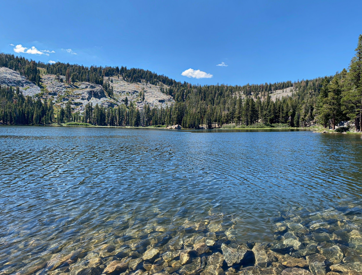
Tamarack Lake
Trailhead: Echo Lakes
Route Type: Out and back
Distance: 7.2 miles roundtrip
Elevation Gain: 800 feet
Permit Zone: Zone 41, Tamarack
Description: Tamarack Lake is a small alpine lake with crystal clear waters. The hike departs from Echo Lakes and follows the Pacific Crest Trail until a short turn off to the lake. There is a boat that runs across the lake that can be taken to shorten the hiking route. The route is incredibly well-marked and maintained making it an easy and enjoyable journey. Nearby Lake Ralston can also be explored after setting up camp!
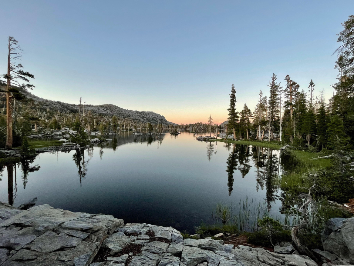
Image: Reddit user
Middle Velma Lake
Trailhead: Eagle Falls
Route Type: Out and back
Distance: 8.9 miles roundtrip
Elevation Gain: 2,115 feet
Permit Zone: Zone 16, Middle Velma
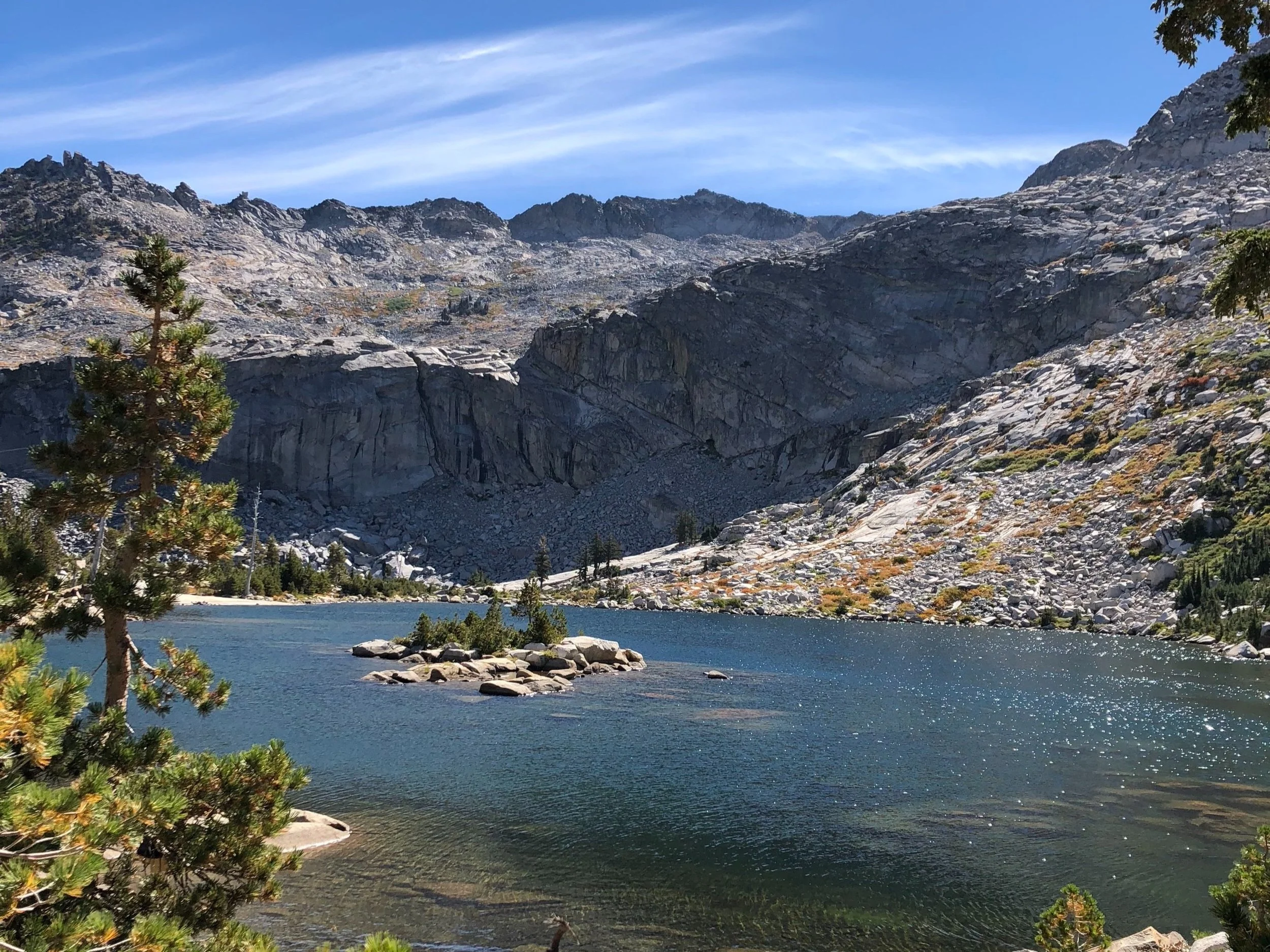
Description: Middle Velma lake is one of three alpine lakes in the group of Velma Lakes. The trail ascends steadily from the trailhead along the Eagle Falls trail winding its way through beautiful pine forests and rocky terrain. Take a quick side trail to explore Eagle Lake on the way up. The climb is challenging and constant but well worth it when you arrive at the deep blue lake surrounded by granite with plenty of amazing campsites.

Image: Reddit user
Lake of the Woods
Trailhead: Echo Lakes
Route Type: Out and back
Distance: 10.3 miles roundtrip
Elevation Gain: 1,600 feet
Permit Zone: Zone 40, Lake of the Woods
Description: Lake of the Woods is a fan favorite backpacking destination! It can be reached by hiking along the Pacific Crest Trail from Echo Lakes, beyond Tamarack Lake with a longer and more challenging climb. Backpackers must camp at a designated campsite (look for wooden posts marking each campsite), this ensures the landscape surrounding the lake is not damaged. Explore the western side of the lake for a little more remoteness, designated camping is not required on this side of the lake.
2 Night/3 Day Trips:

Lake Aloha
Trailhead: Echo Lakes
Route Type: Out and back
Distance: 13.5 miles total
Elevation Gain: 1,660 feet
Permit Zone: Zone 41, Tamarack
Campsite Night 1: Tamarack Lake
Campsite Night 2: Lake Aloha
Description: Lake Aloha is the crown jewel of Desolation Wilderness! The most famous lake of the region with crystal clear waters and a stunning mountainous backdrop including Mt Price and Pyramid Peak. It is a beautiful spot to camp, swim and enjoy a sunrise. For a breathtaking three day trip, head to Tamarack Lake for one night and then make your way to Lake Aloha for the second night. Both lakes are found along the Pacific Crest Trail.
Middle Velma and Dicks Lake Loop
Trailhead: Eagle Falls
Route Type: Lollipop
Distance: 11.1 miles total
Elevation Gain: 2,550 feet
Permit Zone: Zone 16, Middle Velma
Campsite Night 1: Middle Velma
Campsite Night 2: Dicks Lake
Description: This is a beautiful lollipop shaped loop that backpackers can complete over three days. On day one, hike up the Eagle Falls trail to set up camp at Middle Velma Lake - be sure to make a pit stop at Eagle Lake. On day two, set off to explore Fontanillis Lake before setting up camp next to Dicks Lake for the night. Dicks Lake has plenty of gorgeous campsites along the northern end of the lake.

Grass and Susie Lake
Trailhead: Glen Alpine
Route Type: Out and back
Distance: 10.8 miles total
Elevation Gain: 1,800 feet
Permit Zone: Zone 35, Grass
Campsite Night 1: Grass Lake
Campsite Night 2: Susie Lake
Description: Head up to Grass Lake along the Glen Aulin trail for your first night in the wilderness. On day two, continue along the Glen Aulin trail before transferring onto the Pacific Crest Trail which leads to Susie Lake. If you have extra time in the day, head up to Heather Lake and Lake Aloha to uncover the beauty of two more alpine lakes.
Wilderness Regulations
Permits are required for day and overnight visits year-round and a signed hard copy must be carried with you to be valid
Campfires are prohibited but camp stoves may be used
A bear canister must be used to store food and toiletries and any other scented items
Human and dog waste must be disposed in a cat hole at least 200 feet from water or trails. All toilet paper should be packed out with you
Campers must set up camp at least 100 feet from lakeshores, streams, and trails
Maximum group size allowed is 12, although certain zones have quotas smaller than 12
Maximum stay is fourteen days
Soap is prohibited from being used in any water source (even biodegradable soap!)
Dogs must be under control and leashed at all times
Clean cookware at least 200 feet from water sources
Respect signed restoration sites to allow them to recover from overuse
Do not damage or remove any naturals features
Practice Leave No Trace to preserve the area’s beauty!
Quick Links